These projects involved design, waterway permitting, and approach roadway design of four structures under DCNR Project No. FDC-800-102187.1 for Wen-Brooke Contracting, Inc.
DCNR
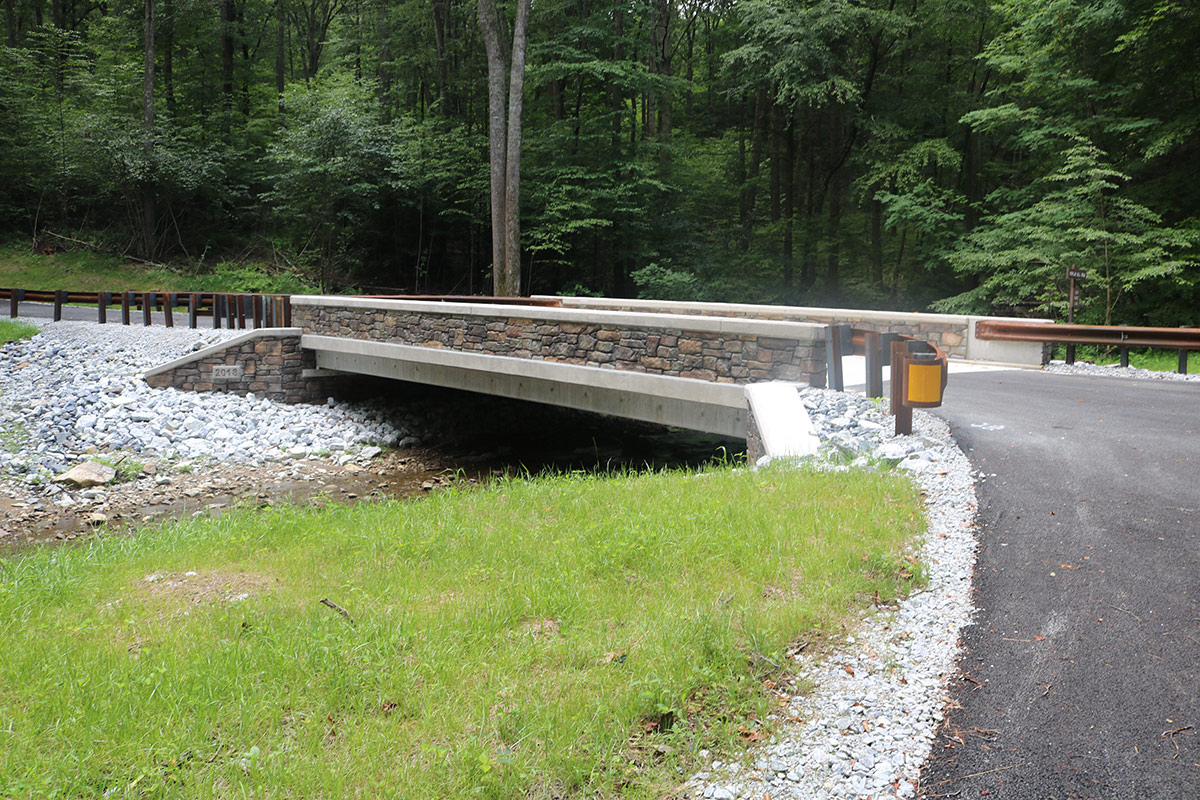
This project involved removal of the existing structure and construction of a bridge to carry Babcock Creek Road over Babcock Creek in DCNR Forest District 6, Gallitzin State Forest.
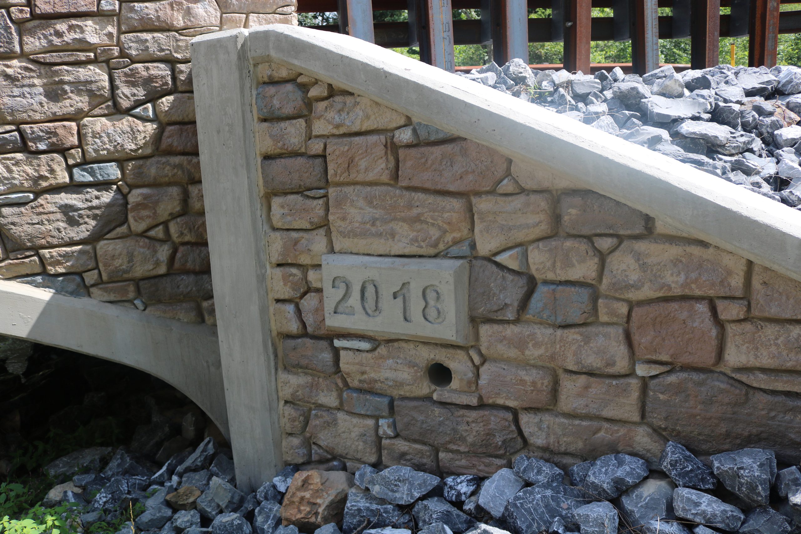
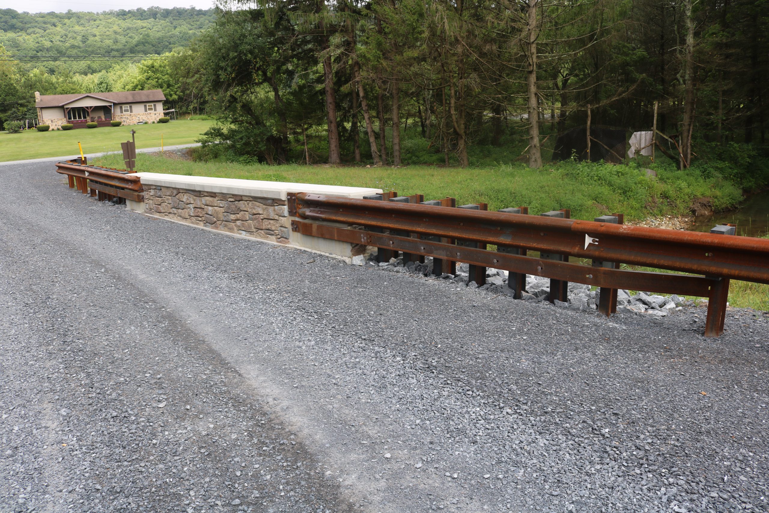
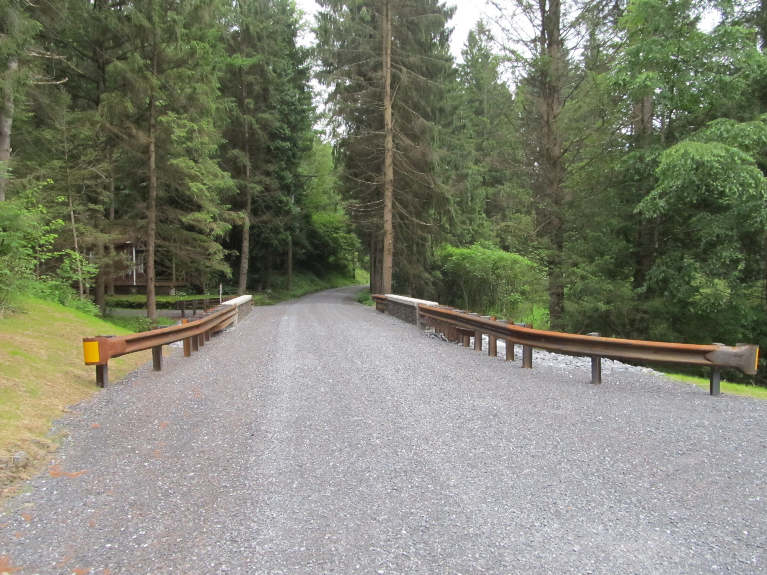
The bridge replacement project included a single span precast rigid frame structure supported on cast-in-place reinforced concrete abutments with independent reinforced concrete wingwalls. The final design has a clear span of 22’-0” and sets on a 90-degree skew. This configuration provides a larger waterway opening that improves the hydraulic capacity. Alternate vertical wall barriers were constructed parallel to the survey and construction centerline. The bridge now has a clear roadway width of 18’-0” and an overall out to out width of 21’-0”.
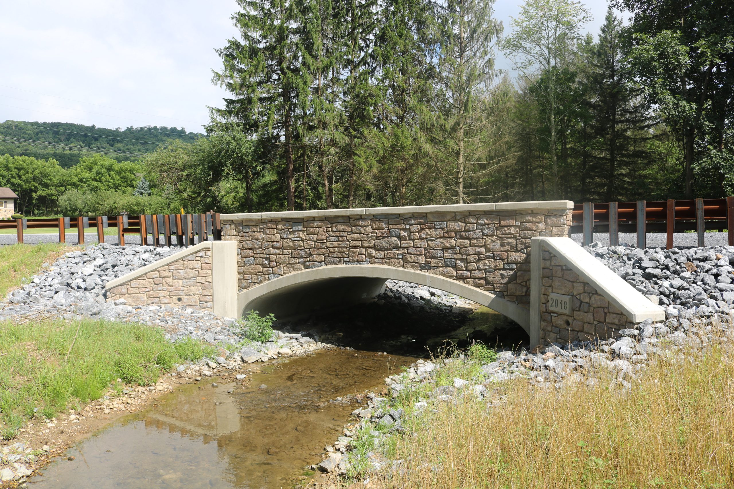
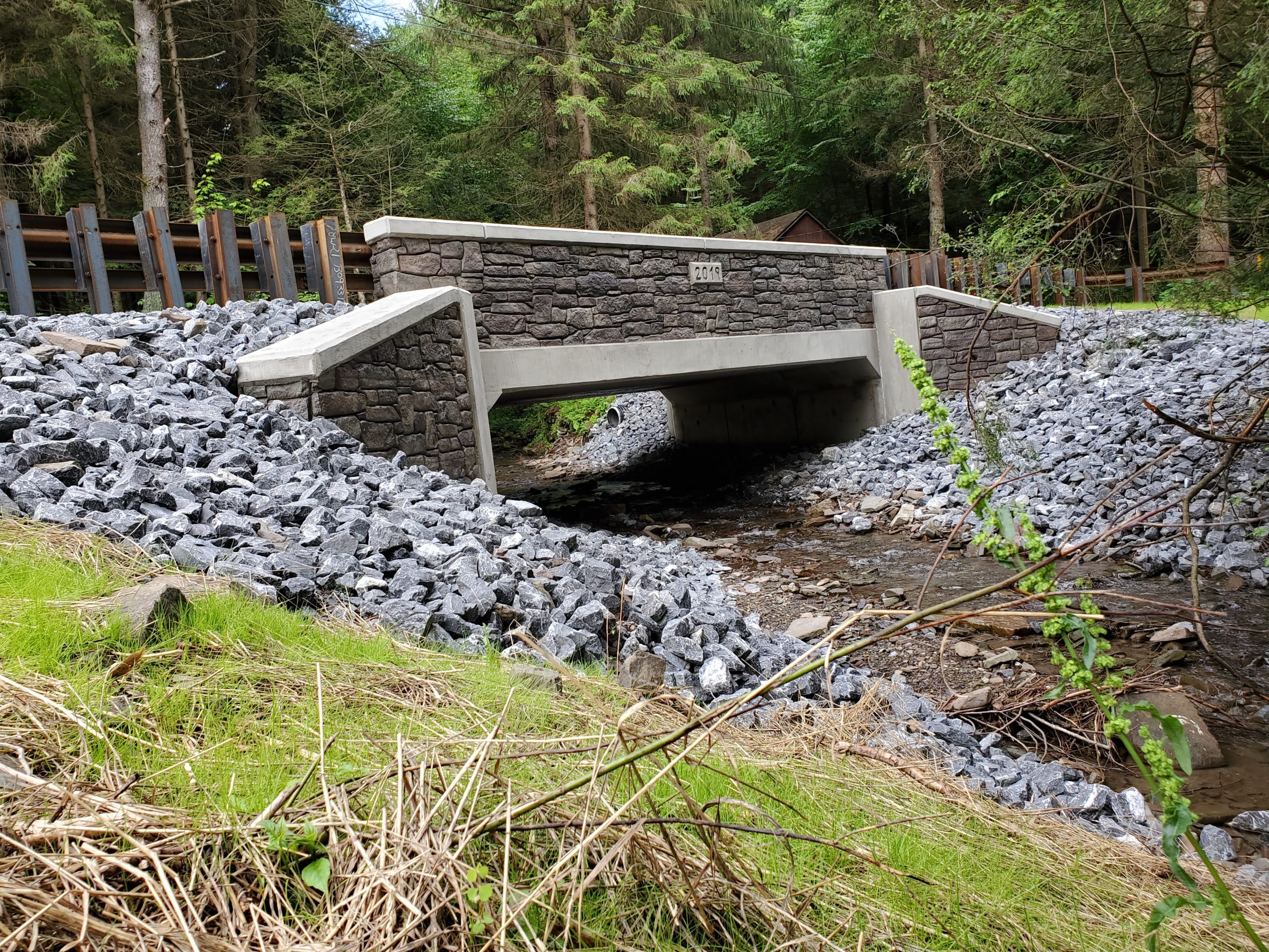
The project included the removal of the former structure and construction of a bridge to carry Tailgate Road over an unnamed tributary to Licking Creek in DCNR Forest District 2, Buchanan State Forest.
The bridge replacement included a single span precast concrete arch structure supported on cast-in-place reinforced concrete abutments with independent cast-in-place reinforced concrete wingwalls. The replaced bridge has a clear span of 24’-0”. The new structure sets on a 90 degree skew. This configuration provides a larger waterway opening that will improve the hydraulic capacity compared to the former structure. Alternate Vertical Wall Barriers with architectural surface treatment were constructed parallel to the survey and construction centerline. The bridge has a clear roadway width of 20’-0 1/2” and an overall out to out width of 24’-0 1/2”. The driving surface aggregate (DSA) roadway surface over the structure now has a 2% normal crown. The new structure is located on a new alignment approximately 26’ upstream of the former structure.
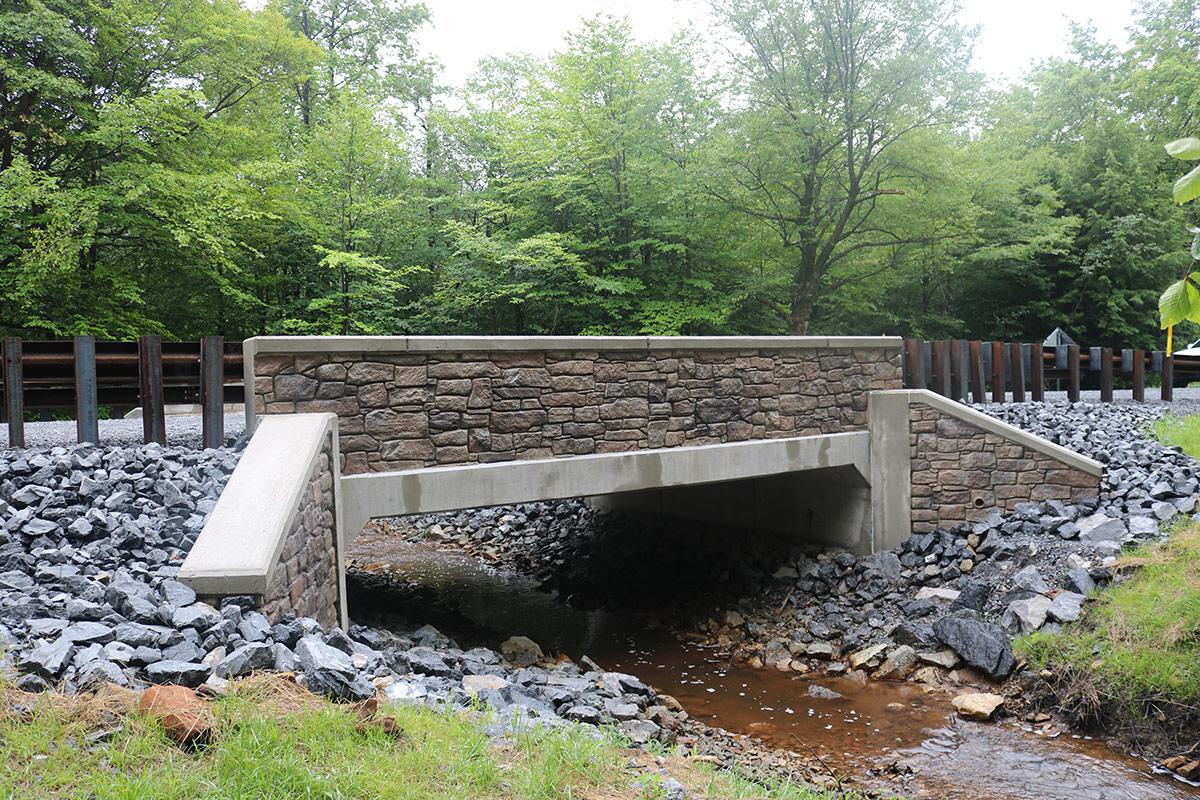
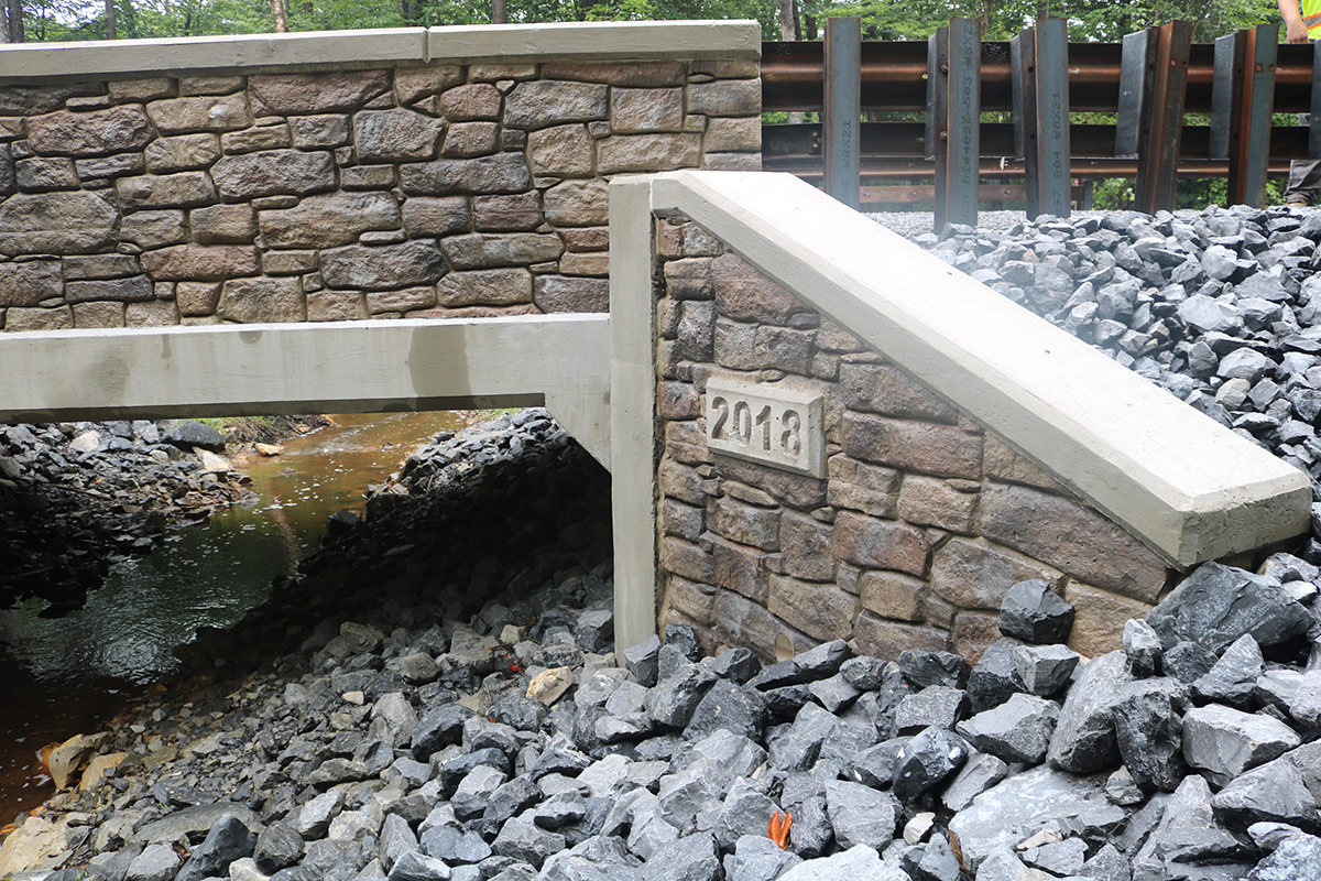
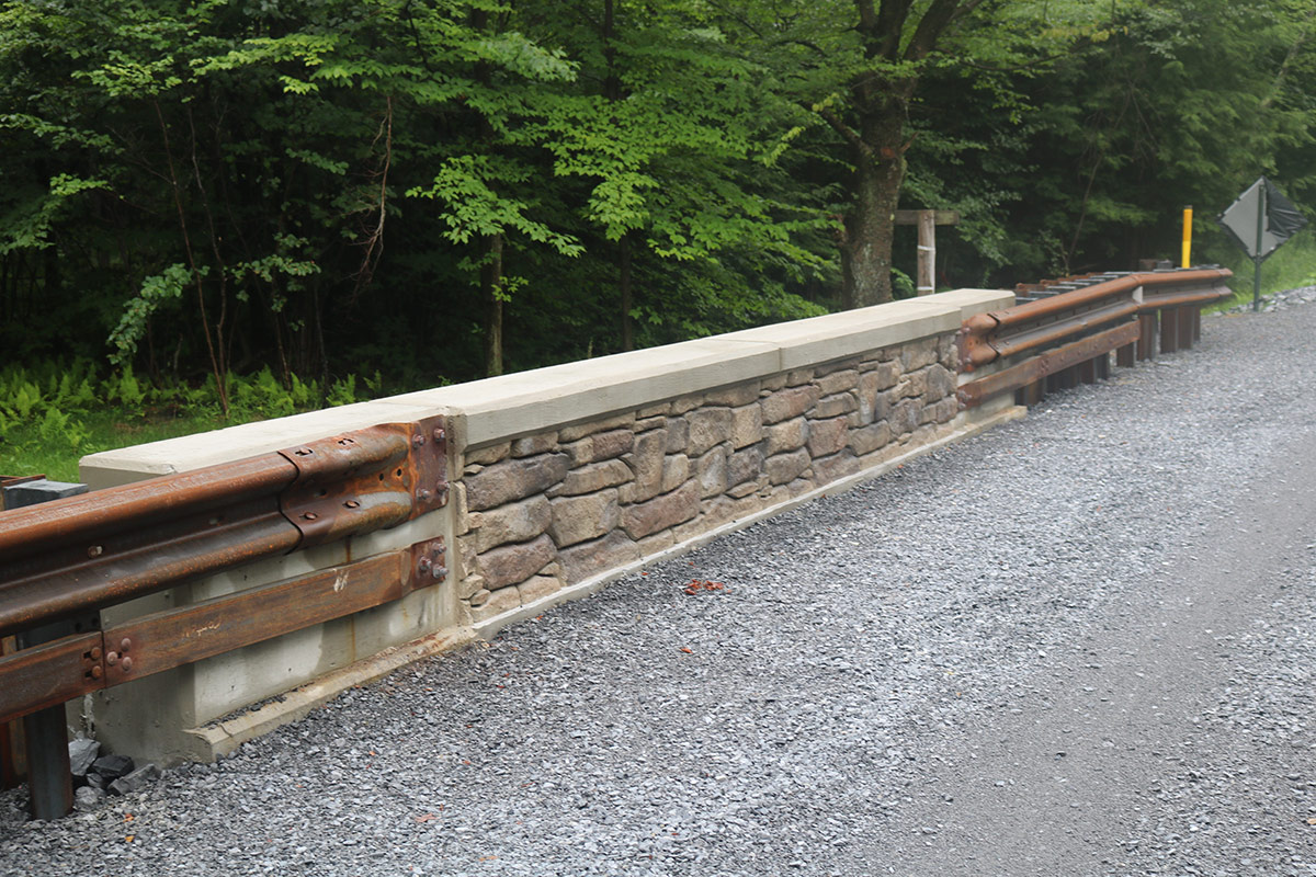
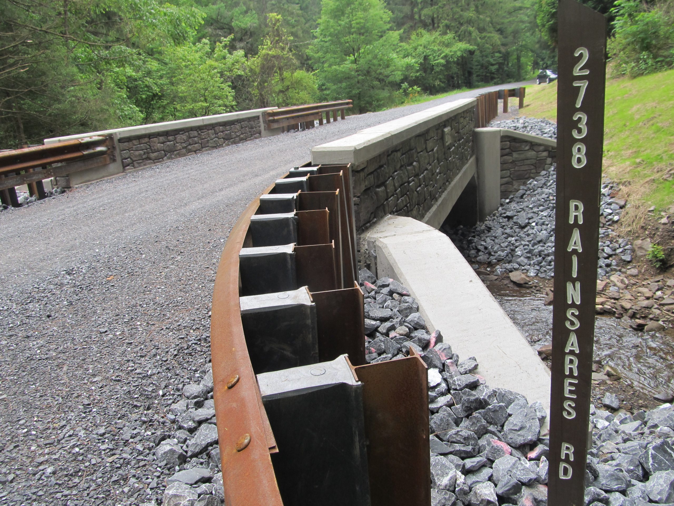
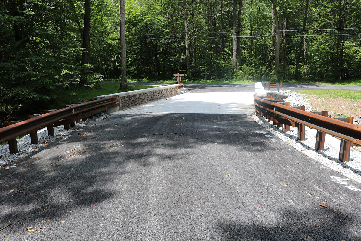
The project included the removal of the former structure and construction of a bridge to carry Riansares Road over Cooper Run in DCNR Forest District 7, Bald Eagle State Forest.
The replacement bridge is a single span precast rigid frame structure supported on cast-in-place reinforced concrete abutments with independent reinforced concrete wingwalls. The new bridge has a clear span of 24’-3 1/4” along the roadway centerline and 22’-0” normal to the abutments. The new structure sets on a 65 degree skew. This configuration provides a larger waterway opening that will improve the hydraulic capacity compared to the former structure. Alternate Vertical Wall Barriers with architectural surface treatment were constructed parallel to the survey and construction centerline. The bridge now has a clear roadway width of 18’-6” and an overall out to out width of 21’-6”. The driving surface aggregate (DSA) roadway surface over the structure has a 2% normal crown.
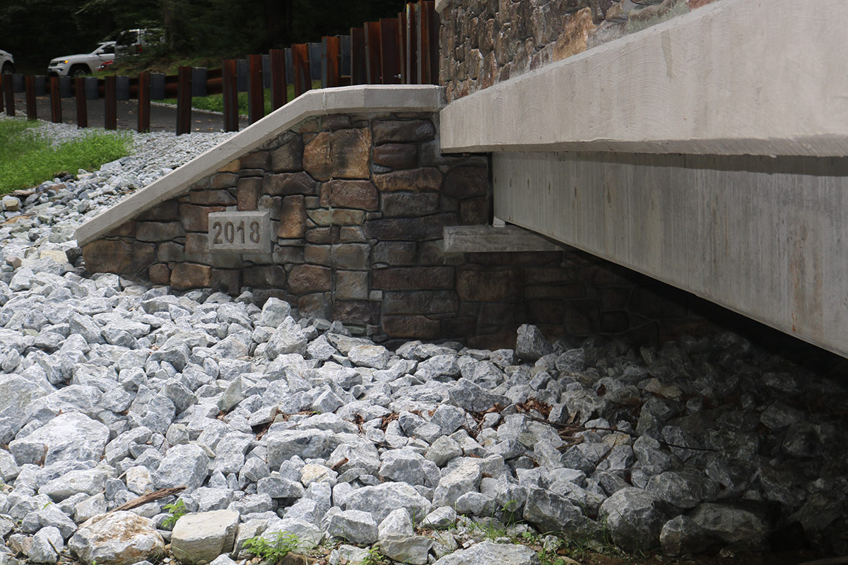
The project included the removal of the former structure and construction of a bridge to carry Poplar Hill Road over Middle Creek in DCNR Forest District 1, Michaux State Forest.
The new bridge is a single span prestressed concrete composite spread box beam superstructure with a reinforced concrete deck supported on cast-in- place reinforced concrete abutments with independent reinforced concrete wingwalls. The bridge has a center to center bearing distance of 42’-0” with a normal clear span of 40’-0” and sets on a 90-degree skew. This configuration provides a larger waterway opening that improves the hydraulic capacity. Alternate vertical wall barriers were constructed parallel to the survey and construction centerline. The bridge now has a clear roadway width of 20’-0” to accommodate two 10’-0” wide traffic lanes with an overall out to out width of 23’-0”.
Penn Cambria School District has collaborated the last 4 years with the Keller Engineer’s team to complete a multi-phased paving and drainage project on our HS campus. I have personally worked with Adam Long, Brian Smith and Shawn Ritchey throughout the entire project and they made Penn Cambria feel like we were their only client. The personal attention to our needs and specific details of this project were second to none. The communication aspect of the Keller Engineer Team was outstanding. We trust their process, their design and their commitment to a quality project that when completed, we are all very proud of. Bill Marshall, Superintendent Penn Cambria School District